×

The Impact of Thermal Satellite Images

On Episode 27 of The Satellite & NewSpace Matters Podcast we were joined by Tobias Reinicke, the CTO and Co-Founder at Satellite Vu. Tobias has an extensive background in geography and computing with a career spanning over two decades in the aerospace industry. His main focus has been creating advanced solutions for global mapping. Satellite Vu is on a mission to build high resolution thermal data through the launch of their first satellite, the HOTSAT-1 in June, and the recent release of the first light imageries. Tobias explained the importance of using these images to protect our planet, and how companies can plan for the future using the same technology. Read on for his insights. 

How can organisations use thermal imaging data to change their behaviours?

As a company we can detect heat loss at a very high level. Any industry or activity that is based on heat production, we can infer activity levels of. So you can imagine that companies that run large equipment, factories, refineries, or that sort of infrastructure, would request data for their own sites and connected sites that they may not have easy access to, to assess where they are losing heat. Because we’re a global service, we can give them a holistic view of all their assets and sites, and provide a benchmark for their site, showing if they are running at a certain level of capacity. 

Companies have a mandate according to their emissions and wastage of heat that they need to abide by. We can show you whether your sites are achieving that or not. At the same time, if you’ve made some changes, we can show you what the before and after looks like so that you can validate that your changes have made an effect. As legislation and policies come into place in many countries, we are going to be able to help companies assess the situation and help them make the decision with our datasets. We hope to play a key part in monitoring assets that are coming online, are supposed to be coming offline, or are being retrofitted to be more efficient.

What are some of the benefits of infrared imaging sensors compared to other types of sensors?

There’s a bunch of other sensors, such as optical, where you’d see what the sun reflects, but that precludes you from collecting data at night. Again, you can derive activity by looking at cars or trucks being in place, etc, but you can’t see any actual heat losses or infer anything else. You have synthetic aperture radar, which can look at nighttime as well, which is the closest you can get to thermal on that sort of capability. But again, it doesn’t give you any colour because it’s a radar bounce, so it’s a bit tricky to interpret sometimes. Otherwise you can see actual activity by looking at the hyperspectral multispectral solar solutions, which look at gas emissions. Companies like GHGSat are looking at anything to do with emissions, which our bandwidth does not allow us to do. But on the other side, GHGSat can’t derive heat loss. A combination of sensors are going to create the best picture.

What can we learn from this data from the initial images?

The first image we got from the satellite was at Rome, it was a nighttime image, and you can very clearly see some heat around the place. Looking in the northwest of the image was the Vatican, which showed up as really hot. The reason for this was most probably because it is made up of large slabs of concrete. When we get into this city analysis and city planning, materials like concrete, stone, brick and tarmac retain heat really well, and emit it at night, which is both a good thing and a bad thing. It’s fine in the winter, but not too great in the summer when you’re creating urban heat islands. Otherwise, in Rome, we can see a nice river flowing through and you can see that the water is very cool. You can see the green areas are much cooler. You can infer a lot from this and play with it on the urban planning front. 

How can satellite imaging help mitigate the effects of climate change? 

We will be a monitoring service. We will be able to monitor what’s going on; there’s not much else we can do other than that. But I think that if you don’t know where your biggest heat losses and emissions are, you’re not going to be able to do anything about it. That’s very much what we’re there for – to give it a global, holistic and uniform view of the sites that are emitting the most heat and therefore producing the most waste. Asset owners and policymakers want to know about that, and then when they’ve made the changes they want to know how they’ve actually improved the situation. That’s how satellite imaging will help. 

To learn more about satellite imaging and the work that Satellite Vu are doing in the area, tune into Episode 17 of The Satellite & NewSpace Matters Podcast here

We sit down regularly with some of the biggest names in our industry, we dedicate our podcast to the stories of leaders in the technologies industries that bring us closer together. Follow the link here to see some of our latest episodes and don’t forget to subscribe.     
The Future of Aerospacelab

The satellite industry is a rapidly developing space, with new technology and applications emerging at a steady pace. On Episode 25 of The Satellite & NewSpace Matters Podcast we spoke to Benoît Deper, the CEO and founder of Aerospacelab, about how he sees the future of the industry unfolding. Aerospacelab was founded in 2018, with the aim of making geospatial intelligence both actionable and affordable, with its fully vertically integrated approach. Just last month, they launched their second satellite on a falcon nine rocket. Following these advancements, we asked Benoît about what we can expect to see from the company next. 

What’s the most exciting recent development that you’re working on now?

What we’re building is quite interesting. We are trying to find the right balance between custom and standardised satellite buses, and we are iterating on that. What we discovered so far is that fully standardised buses are not what the customer wants, because they want to feel special and have their particular needs and requirements met. But, at the same time, they like the standard price. The real challenge is to find something that looks like a customised product, but has a price tag that is more in line with the standardised product. It is quite exciting to oscillate between the two sides and find a path where we believe we can converge to create something that is exciting for our customers. 

What are you most excited to see Aerospacelab achieve in the next 3-5 years? 

Now it’s a matter of scaling and being profitable. So again, it’s quite interesting to see what our technology will look like after the first couple of years. We have started to see some territory that would allow us to do that. Not everything is going according to plan, because as Napoleon said, ‘the plan is only valid until the first shot is fired’. However, we’re on track to meet our KPIs. Not that far in the future we hope to be profitable. For a NewSpace company that is huge, because it’s a small world where we have many brands, and we talk to each other quite often. Not that many NewSpace companies are actually profitable out there, so we’re excited to reach that goal. 

To hear more from Benoît about the future of the industry, tune into The Satellite & NewSpace Matters Podcast here

We sit down regularly with some of the biggest names in our industry, we dedicate our podcast to the stories of leaders in the technologies industries that bring us closer together. Follow the link here to see some of our latest episodes and don’t forget to subscribe.     

Companies to watch in the Satellite and Space Technology Markets 2021

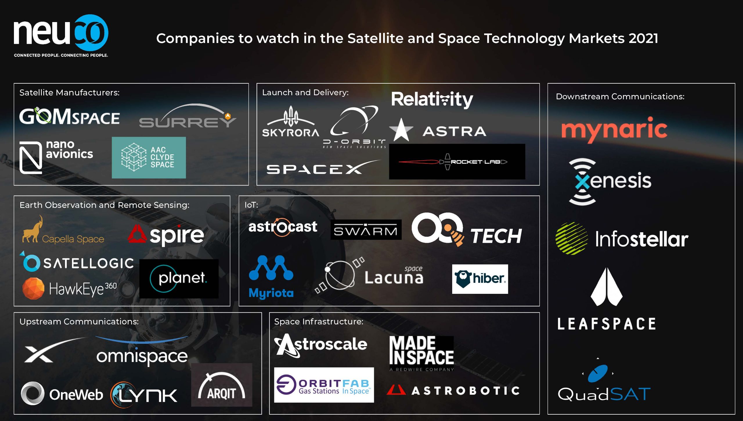
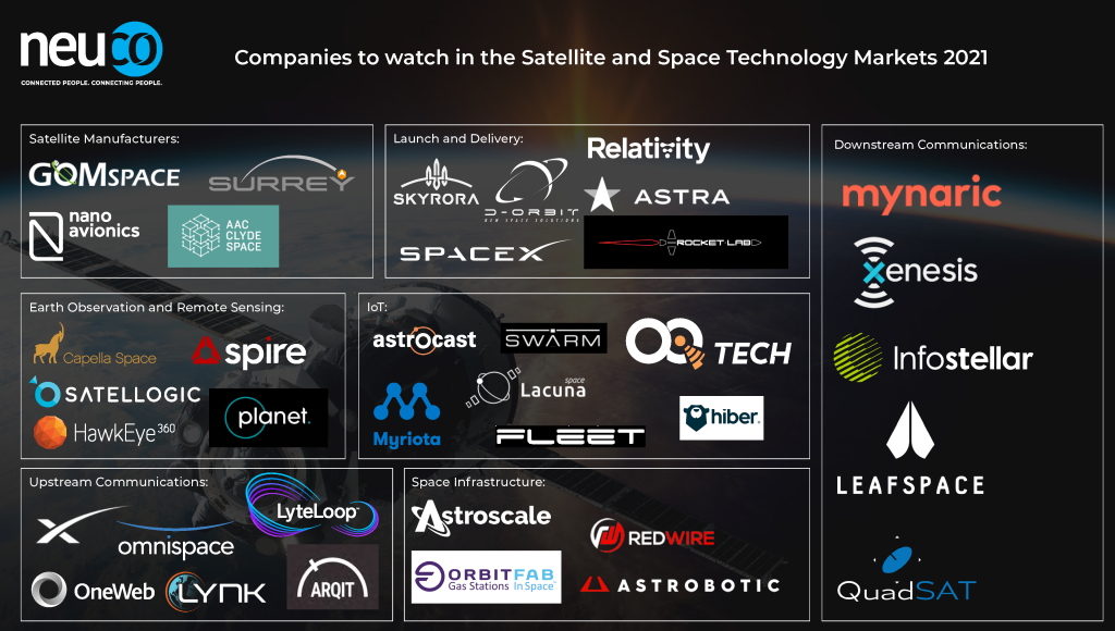
In the ever-changing and fast-paced market of Satellite and Space Technology, there are many start-ups and businesses making amazing strides on the bleeding edge of the industry. We spoke to our team of Satellite & NewSpace consultants who work closely with the trailblazers in Space to get their list of the most exciting companies to watch in the Satellite and Space Technology Markets – 2021.

We’ve created an Infographic listing all the companies. Please feel free to share on social and download below!


Satellite Manufacturers:

AAC Clyde Space – https://www.aac-clyde.space/ 

SSTL – https://www.sstl.co.uk/ 

Nano Avionics – https://nanoavionics.com/ 

GOMSpace – https://gomspace.com/home.aspx 


Launch and Delivery:

Rocket Lab – https://www.rocketlabusa.com/ 

Relativity Space – https://www.relativityspace.com/ 

SpaceX – https://www.spacex.com/ 

Astra Space – https://astra.com/ 

Skyrora – https://www.skyrora.com/ 

D-Orbit – https://www.dorbit.space/ 


Earth Observation and Remote Sensing:

Capella Space – https://www.capellaspace.com/ 

Spire – https://spire.com/ 

Planet – https://www.planet.com/ 

HawkEye 360 – https://www.he360.com/ 

Satellogic – https://satellogic.com/ 


IoT:

Hiber – https://hiber.global/ 

Myriota – https://myriota.com/ 

Astrocast – https://www.astrocast.com/ 

Swarm Technologies – https://swarm.space/ 

Lacuna Space – https://lacuna.space/ 

OQ Technology – https://www.oqtec.space/ 


Upstream Communications:

Starlink – https://www.starlink.com/ 

OneWeb – https://www.oneweb.world/ 

ArQit – https://www.arqit.io/ 

Lynk – https://lynk.world/ 

Omnispace – https://omnispace.com/ 

LyteLoop – https://www.lyteloop.com/


Space Infrastructure:

Astroscale – https://astroscale.com/ 

Orbit Fab – https://www.orbitfab.space/ 

Astrobotic – https://www.astrobotic.com/ 

Redwire – https://redwirespace.com/


Downstream Communications:

Mynaric – https://mynaric.com/ 

Xenesis – https://xenesis.io/ 

Infostellar – https://infostellar.net/ 

Leafspace – https://leaf.space/ 

Quadsat – https://www.quadsat.com/